Jan 3: Kashmir / Himachal Snow Conditions
Overall Theme
by Zeeshan Mushtaq (dec)
The western Himalayas have experienced a late start to the season, with limited early snowfall. Almost a one month later than Europe cycle as seen in the French alps
However, a surprise storm at the end of December has brought much-needed snow, setting the stage for this season's base snow cover.
What’s Happened Since October?
- October: One of the driest Octobers in history for the western Himalaya
- November: Sporadic snowfall up to 5000 meters, with most snow disappearing quickly:
- Solar aspects: Nearly all snow melted.
- North-facing aspects: 1-3 cm persisted in cold, sheltered zones.
- December (early to mid):
- Late November: Precipitation higher in certain areas:
- Sonamarg and Gurez: Accumulations up to 1 foot in high elevations.
Pahalgam by Zeeshan Mushtaq ( early mid dec)
- Upper Kullu Valley, Gondala (Lahaul), Sissu, and Pir Panjal: few cms on average.
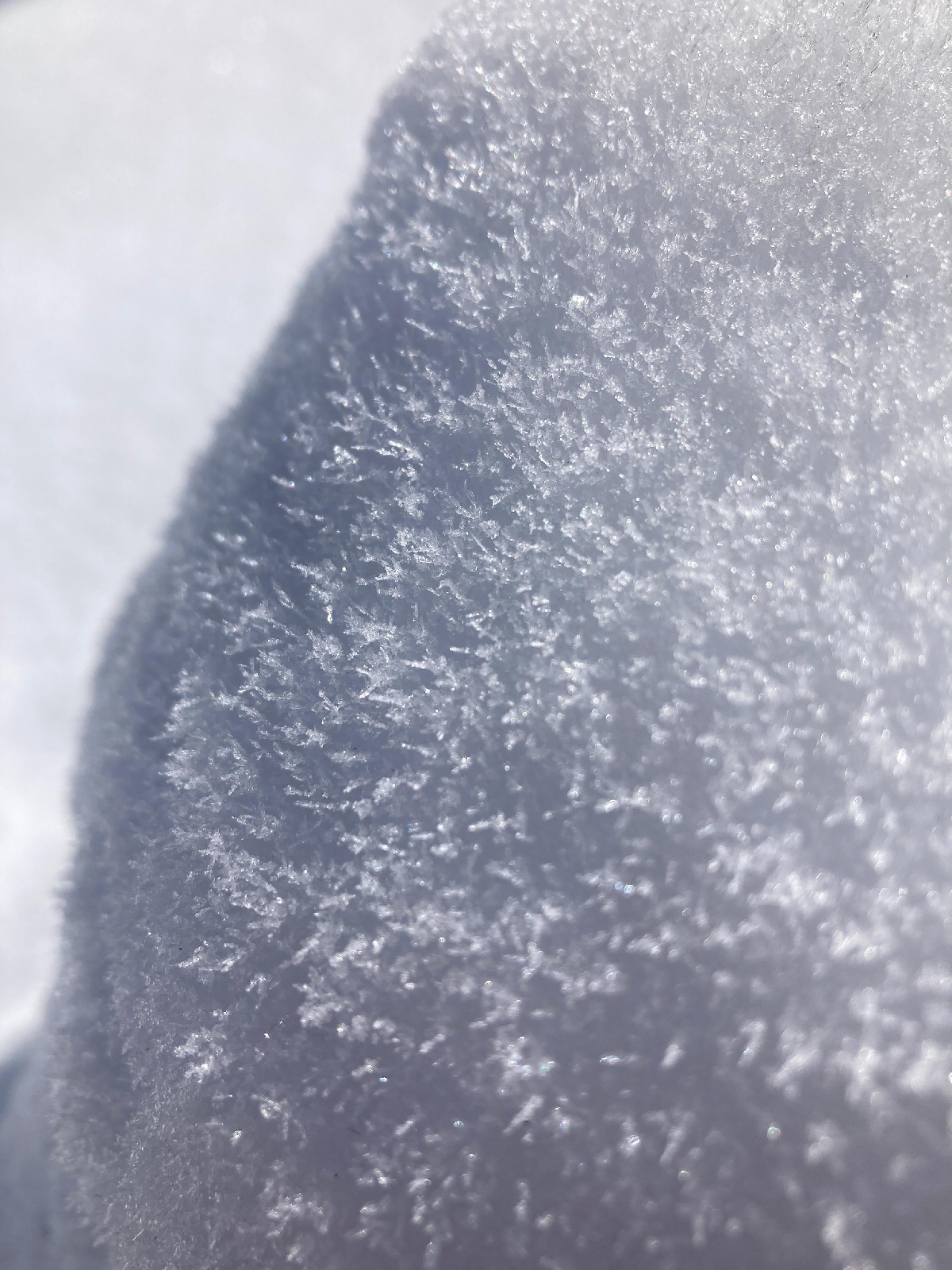
- Cold and dry conditions: The snowpack in Upper Kashmir wherever it existed, showed signs of some faceting.
- Late December (December 27-28 Storm):
- This storm delivered widespread snowfall across the western Himalayas:
- Gulmarg, Sonamarg, Upper Kullu Valley, Sissu, Sethan (above Manali): ~2 feet.
- Kelong: ~1 foot.
- While areas in Kashmir that already had a foot or lesser snow cover (moderately faceted), they would see layering of this storm snow over it.
- Other areas in Himachal will have this storm snow become its base layer.
- Some surface hoar was observed in Zojila on 31st Dec (bordering regions of Kashmir and Ladakh) upon this new snow
Current Conditions
- Snowpack Stability:
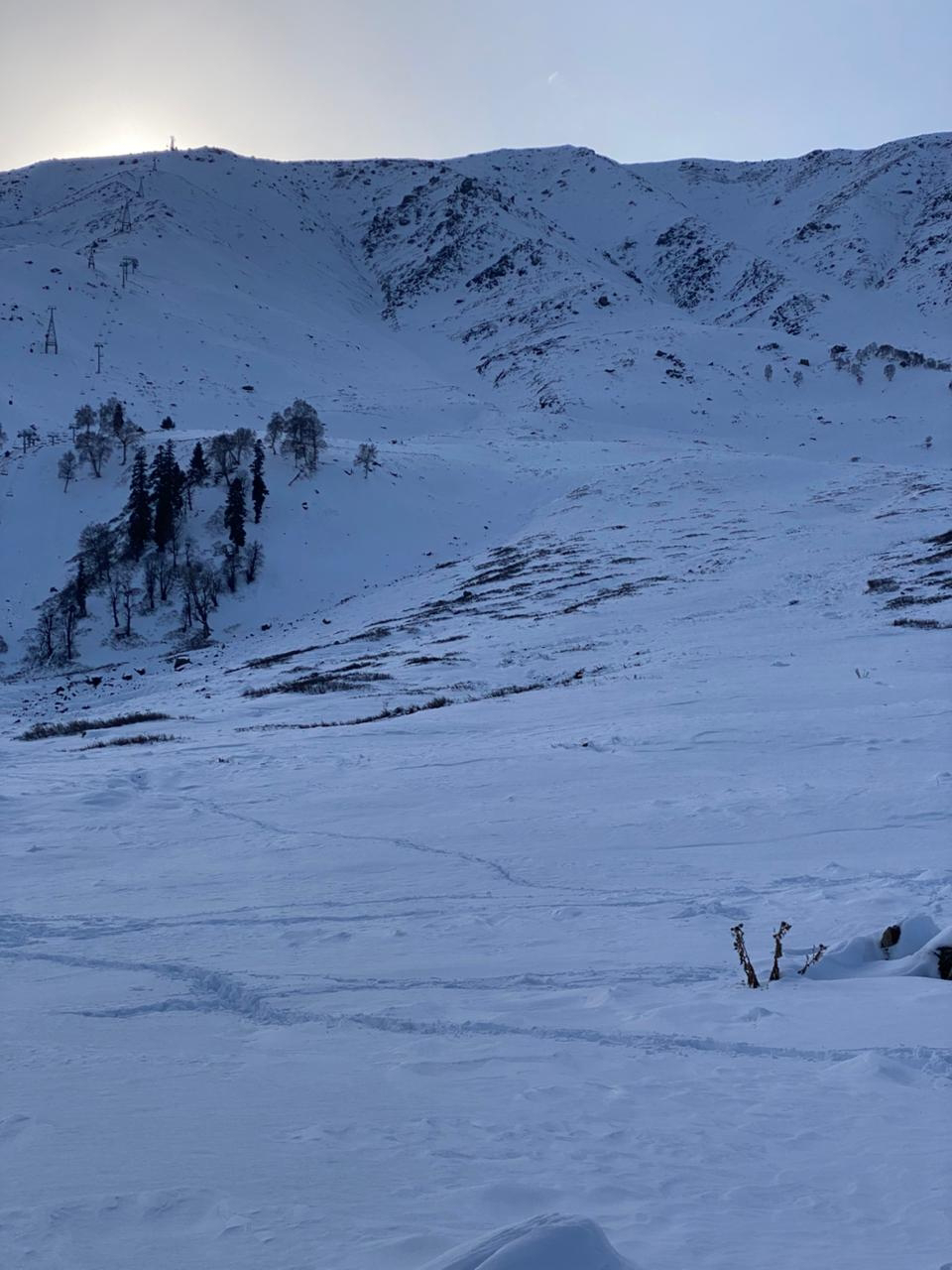
View of chairlift and main gondola bowl. Pic by Burhan
- Generally thin and lacking significant mechanical layering.
- Limited avalanche activity so far due to insufficient snowpack volume. Altough storm sluffing has been observed on steep aspects.
- Skiing Conditions:
- Gulmarg: Powder dry but thin snowpack, particularly around the tree line.
pic by Burhan
- Sethan (above Manali): Similar to Gulmarg, with reports of dry powder but many exposed hazards ("sharks").
- Lahaul: No reported backcountry skiing due to the thin snowpack.
What’s the Weather and Avalanche Forecast?
- January Outlook:
- Moderate precipitation expected by the first week of January, followed by another low-pressure disturbance around January 10.
- These storms are likely to create significant layering in the snowpack, altering stability and increasing avalanche risks.
- Regional Highlights:
- Pahalgam and Sonmarg: Persistent slab problems expected as new snow overlays the faceted December base.
- Melt-freeze crust over faceted snow topped with fresh snow.
- Gulmarg: a 1-2 ft base with varying extent of faceted snow will be loaded with incoming snow, creating layering. Please visit Gulmarg Avalanche Center website for more complete forecast.
- Sethan / Upper Kullu Valley: With a 2-foot base from the December storm, this base has not had sufficient time to facet. Also, weather has been moderate, with cloud cover.
- More detailed field obs will be required to ascertain the kind snowpack structure.
- Rapid Wind loading by incoming snow will create hazards of its own.
- Lahaul: Rapid faceting of snow due to cold temperatures will create precarious conditions, exacerbated by wind-loading of new snowfall.
What to Watch Out for or Avoid Completely
- Avalanche Risks:
- Persistent slab problems in Kashmir (Pahalgam, Sonamarg, Gulmarg) and Lahaul.
- Wind slabs
- Storm slabs sitting over potential surface hoar in cold aspects.
What Are the Key Questions Moving Forward?
- How will the snowpack react to upcoming precipitation events?
- Will the snow dumb be sufficient to create flushing of any base weaknesses?
- Will surface hoar development and melt-freeze crust layering lead to avalanche problems?
- How will wind-loading affect stability in exposed zones?
please leave comments,
feel free to ask questions or report inconsistencies or anything.
thanks for reading!!
feel free to ask questions or report inconsistencies or anything.
thanks for reading!!


.gif)


Hopefully incoming storm will stabilise the snowpack
ReplyDeleteMaybe maybe not..
DeleteNeed sufficient loading to flush out any lingering instability in areas like in alpine north zones of afarwat.
Maybe the 3rd storm couldndonit.
Would love reports on avy obs from lifts if possible, especially for the north bowls like Sheenmai, hapathKhud etc
What does sharks mean?
ReplyDeletewhen snow coverage is thin, "sharks" refer to hidden rocks, stumps, or other obstacles just beneath the surface of the snow.....
Deletethese hazards are like the dorsal fin of a shark barely visible above water—they may be partially exposed or completely concealed, posing a risk to skiers. Hitting a "shark" can lead to equipment damage or personal injury.
That's why don't rush to ski in early conditions
This late Dec impacted south Kashmir regions the most, dumping 2feet+ snow at Aharbal, Verinag, Kulgam-Shopian regions. This time we also saw Pahalgam region recieving good snowfall than previously.
ReplyDeleteYes. Thanks for pointing out.
DeleteAlso if we remember, during the initial forcasts by weather commentators, the idea was that the storm will pass via the south side of Pir Panjal (above jammu, poonch to kishtwar directly) and into western himachal.
So when the unanticipitated strength the storm gained, could it be natural that south Kashmir got the best goods?
Yes. Thanks for pointing out.
ReplyDeleteAlso if we remember, during the initial forcasts by weather commentators, the idea was that the storm will pass via the south side of Pir Panjal (above jammu, poonch to kishtwar directly) and into western himachal.
So when the unanticipitated strength the storm gained, could it be natural that south Kashmir got the best goods?